Maps and Data - TransAtlas
Find maps and charts showing transportation data and trends related to alternative fuels and vehicles.
OR
Sort by:
119 results
Sorry, no results found.
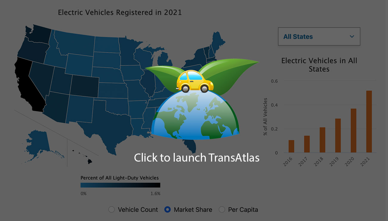
TransAtlas is an interactive map that shows the density of light-duty vehicles per state based on registration counts derived by the National Renewable Energy Laboratory with data from Experian Information Solutions.
Print